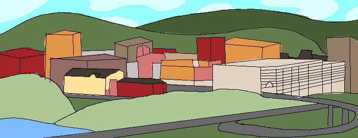
Wexel, WV
County:
Harrison
Established:
1785
Population (2010):
18,254
Density:
1,375.6/sq mi
Website:
Wexel (sometimes Wexell) is a city in Harrison County, West Virginia, United States, and its county seat. The population was 18,254 at the 2010 census, making it the tenth-most populous city in West Virginia. It is the principal city of the Wexel micropolitan area in North Central West Virginia, which had a population of 94,368 in 2010. Wexel was named National Small City of the Year in 2011 by the National League of Cities.
(THIS IS ALL PLAGIARIZED RN)
As early as 1772, settlers began claiming lands near where Clarksburg now stands, and building cabins. In 1773, Major Daniel Davisson (1748–1819) took up 400 acres (1.6 km2), upon which the principal part of the town is now located. By 1774, people settling near present Clarksburg included: Daniel Davisson, Obadiah Davisson (Daniel's father), Amaziah Davisson (Daniel's uncle), Thomas, John, and Matthew Nutter, Samuel and Andrew Cottrill (brothers), Sotha Hickman, and Samuel Beard. Undoubtedly, others were located on these public lands, of which no official records were made.[6] The Virginia General Assembly authorized the town of Clarksburg in 1785. Now a city, it is named for General George Rogers Clark, a Virginian who conducted many expeditions against the British and Indians during the Indian Wars and the war of the American Revolution, including the strategically critical capture of the Forts of Vincennes, now in the State of Indiana, in 1778.
Clarksburg is located at 39°16′50″N 80°20′40″W, along the West Fork River and Elk Creek.[22]
According to the United States Census Bureau, the city has a total area of 9.74 square miles (25.23 km2), all land.[23]
Clarksburg is located in West Virginia's North-Central region. It lies within the ecoregion of the Western Allegheny Plateau.[24]
Clarksburg is located at the junction of U.S. 50 and U.S. 19, two miles west of the junction of U.S. 50 with Interstate 79. The city lies at an elevation of 1,007 feet at the junction of Elk Creek and the West Fork River of the Monongahela River.[9]
As of the census[2] of 2010, there were 16,578 people, 7,213 households, and 4,179 families residing in the city. The population density was 1,702.1 inhabitants per square mile (657.2/km2). There were 8,132 housing units at an average density of 834.9 per square mile (322.4/km2). The racial makeup of the city was 92.9% White, 3.9% African American, 0.2% Native American, 0.3% Asian, 0.3% from other races, and 2.4% from two or more races. Hispanic or Latino people of any race were 1.6% of the population.
There were 7,213 households, of which 28.5% had children under the age of 18 living with them, 38.0% were married couples living together, 14.7% had a female householder with no husband present, 5.2% had a male householder with no wife present, and 42.1% were non-families. 35.3% of all households were made up of individuals, and 14.6% had someone living alone who was 65 years of age or older. The average household size was 2.25 and the average family size was 2.91.
The median age in the city was 39.5 years. 21.9% of residents were under the age of 18; 7.9% were between the ages of 18 and 24; 26.8% were from 25 to 44; 27.1% were from 45 to 64; and 16.3% were 65 years of age or older. The gender makeup of the city was 48.0% male and 52.0% female.
As of the census of 2000, there were 16,743 people, 7,447 households, and 4,378 families residing in the city. The population density was 1,758.3 inhabitants per square mile (678.9/km2). There were 8,662 housing units at an average density of 909.7 per square mile (351.2/km2). The racial makeup of the city was 93.86% White, 3.83% African American, 0.13% Native American, 0.36% Asian, 0.05% Pacific Islander, 0.44% from other races, and 1.34% from two or more races. Hispanic or Latino people were 1.06% of the population.
There were 7,447 households, out of which 25.0% had children under the age of 18 living with them, 41.6% were married couples living together, 13.4% had a female householder with no husband present, and 41.2% were non-families. 36.7% of all households were made up of individuals, and 17.3% had someone living alone who was 65 years of age or older. The average household size was 2.20 and the average family size was 2.87.
In the city, the population was spread out, with 21.1% under the age of 18, 8.3% from 18 to 24, 27.3% from 25 to 44, 22.7% from 45 to 64, and 20.7% who were 65 years of age or older. The median age was 40 years. For every 100 females, there were 86.2 males. For every 100 females age 18 and over, there were 81.6 males.
The median income for a household in the city was $27,722, and the median income for a family was $35,075. Males had a median income of $30,194 versus $22,388 for females. The per capita income for the city was $17,587. About 14.8% of families and 19.8% of the population were below the poverty line, including 28.5% of those under age 18 and 11.9% of those age 65 or over.